A Jakarta-based non-government organization has launched on Thursday “MapaKalamidad.ph,” a web-based, flood reporting platform to help disaster authorities gather fast, reliable life-saving information in times of natural calamities in the Philippines.
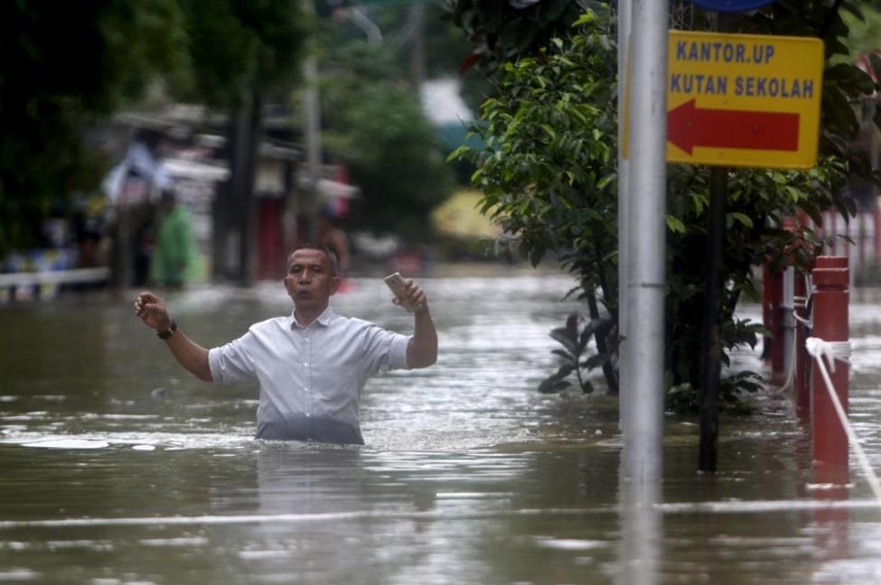 Torrential rains and overflowing rivers flooded dozens on neighborhoods in Jakarta, Indonesia, on New Year's Eve and New Year's Day. (Photo by EPA-EFE/ADI WEDA)
MapaKalaimidad was launched by Yayasan Peta Bencana, or Disaster Map Foundation, during a webinar entitled “Digital Bayanihan! Social Media for Humanitarian Action.”
The launch of the project was done in partnership with the Office of the Civil Defense (OCD), National Disaster Risk Reduction and Management Council, Pacific Disaster Center, and Humanitarian OpenStreetMap Team.
Assistant Secretary Casiano Monilla, Civil Defense Deputy Administrator for Operations at the OCD, in his brief remarks, acknowledged the active participation and support of some local disaster risk reduction management office representatives such as the Province of Pampanga and Quezon City.
“There are many communities in the Philippines working toward providing data to different sectors,” he said. However, he said the coronavirus disease pandemic has altered the landscape.
“The usual social activities such as people physically congregating to exchange and share ideas (are reduced.),” he said.
Through crowdsourcing, he said, MapaKalamidad enables people to not be simply the audience of recipients but also participants in the process of assisting the government in responding to calamities.
As part of the PhilAWARE and USAID Program for Asean Regional and National Capacity Development for Hazard Monitoring, Early Warning and Disaster Management Decision Support, MapaKalamidad.ph provides real-time disaster information and transparent communication between residents and government agencies, in an effort to reduce risk and increase emergency response times.
Joseph Curry, USAID’s Office of Foreign Disaster Assistance and Chris Chiesa, of the Pacific Disaster Center, underscored the use of social media to amplify real-time reporting from the ground through the platform by users whose timely information can help reduce the risk of disasters.
In a news statement, Yayasan Peta Bencana said the online platform harnesses the use of social media to crowdsource disaster information from residents on the ground, who often have the most up-to-date information and displays this information on a live web-based map.
MapaKalamidad.ph is able to filter through reports in a manner that removes the need for expensive and time-consuming data processing by engaging in Artificial Intelligence-assisted conversations with residents through humanitarian chat bots over social media.
The verified crowd-sourced reports are displayed alongside relevant emergency data from local and government agencies.
The platform hopes to provide immediate situational information for residents, first responders and local government agencies to empower them in making informed decisions about safety and navigation, and increasing their response times during disaster scenarios.
Ferth Vandensteen Manaysay and Elton Evidente, researchers for Yayasan Peta Bencana, said the platform draws from the success of PetaBencana.id in Indonesia in using crowd-based and social media-powered platforms to increase community-led disaster co-management.