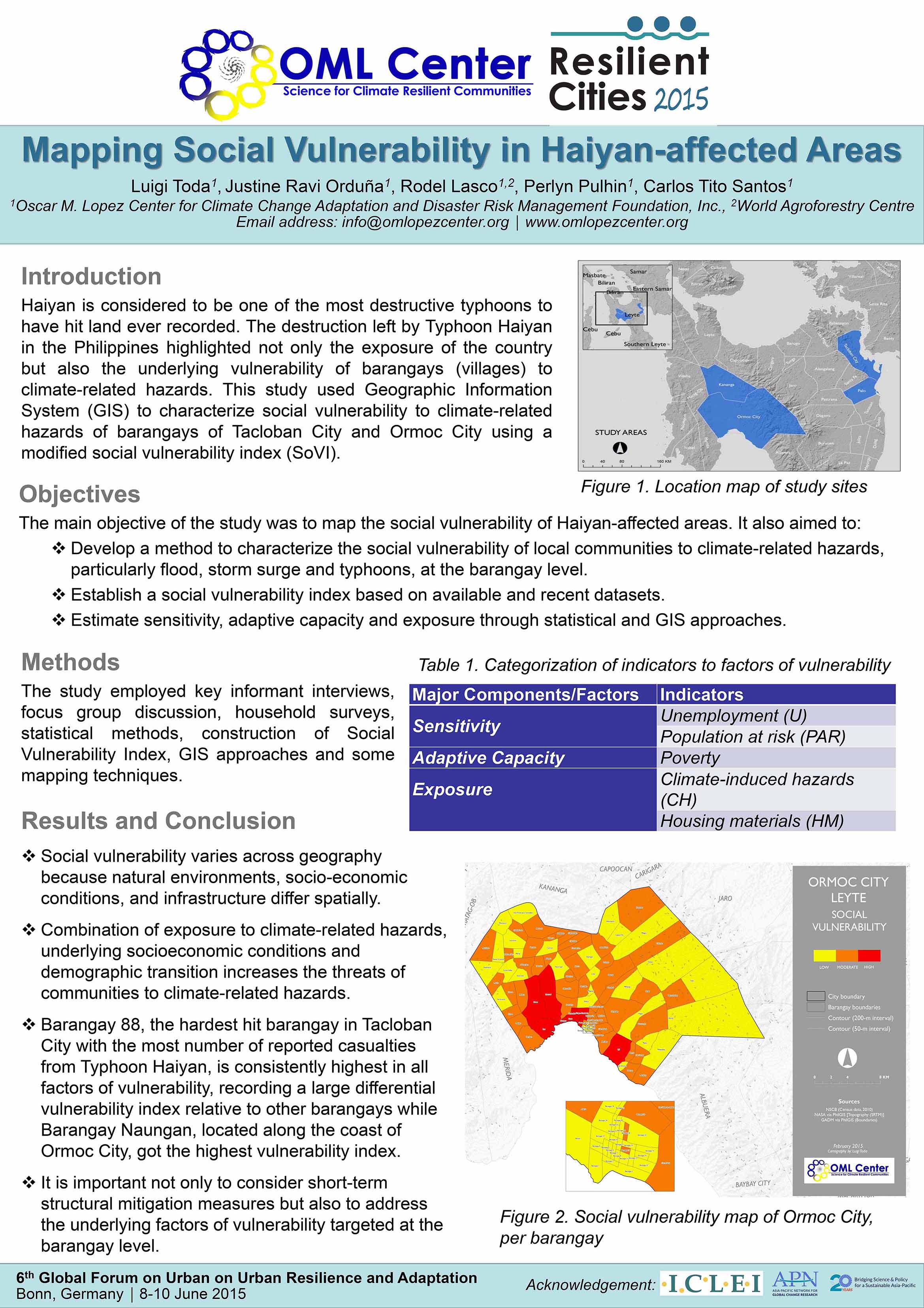
This poster exhibits a study that uses Geographic Information System (GIS) to characterize social vulnerability to climate-related hazards of barangays of Tacloban City and Ormoc City using a modified social vulnerability index (SoVI).
Source: OML Center